
Locals, since my health is poor.
Please refrain
from reaching me
with "under radar" information-
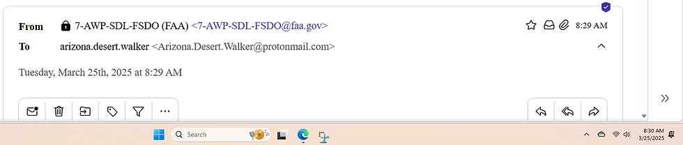
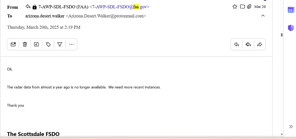
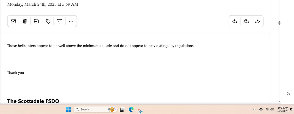
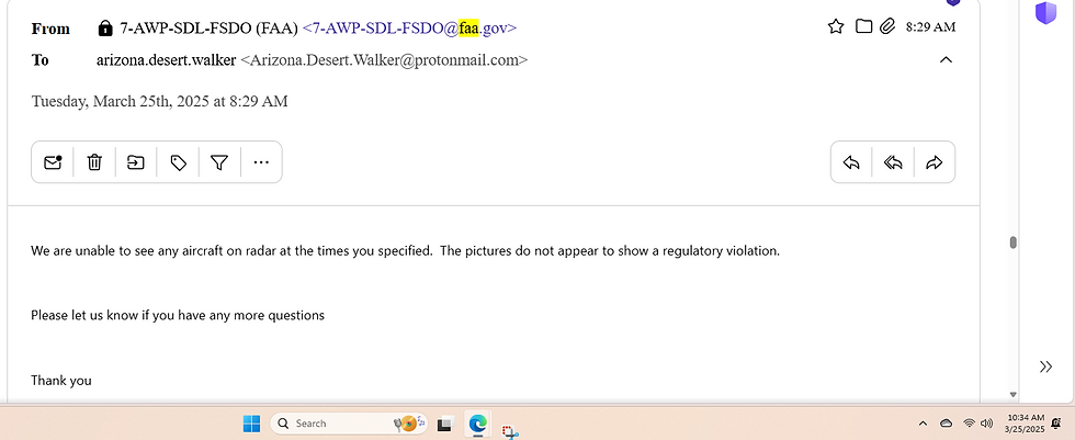
and this is the email to reach FAA
but when creating your email
make sure to provide
metadata, date and time,
location and images/videos.
These are acceptable heights:


I hope this was a helpful local solution
to all your inquiries to me...
I am only focused to my area
due to continued poor health.
If you comprehend this year
has the potential to be one
of the
worst
fire seasons in decades.
It takes us all to do our part.
2025 Could Be One of the Worst Fire Seasons in Decades
—Here’s Why and How to Stay Informed-
If you comprehend this year
has the potential
to be one of the worst fire seasons
in decades, you’re not alone.
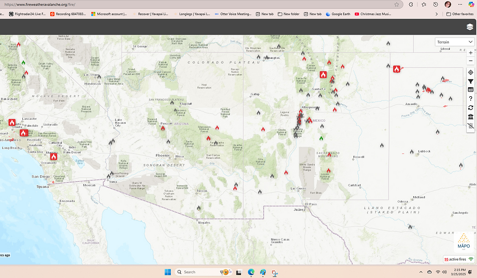
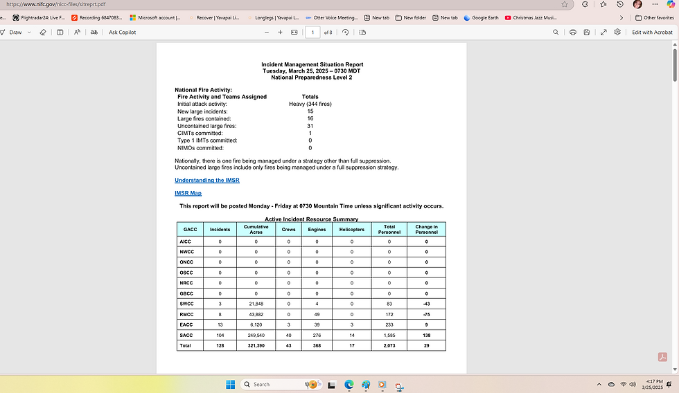
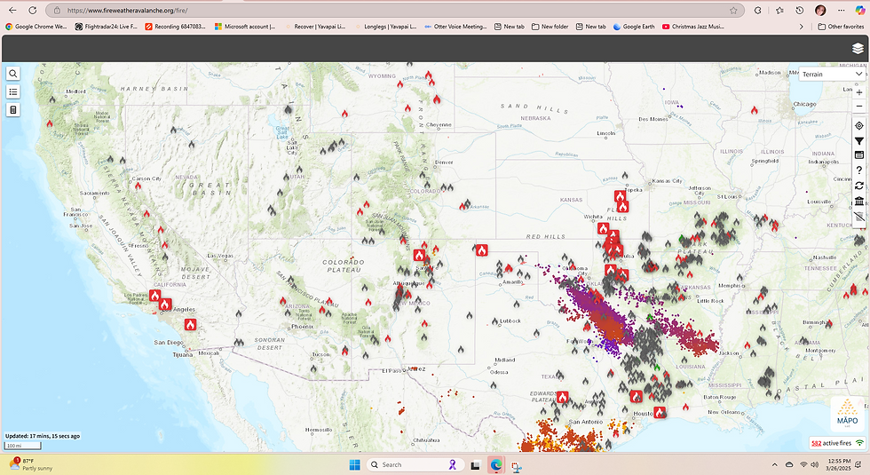
As of March 2025, Arizona is already showing alarming signs of an intense fire year.
Below, I’ve outlined the latest data, the reasons behind this heightened risk, and where you can stay updated with fire weather mapping and online resources.
Current 2025 Wildland Fire Data for Arizona
Number of Incidents: Over 300 wildland fire incidents have been reported in Arizona since January 1, 2025, out of 10,000 incidents over the USA. This is a significant jump compared to the same period in 2024, when fewer than 200 fires were recorded by March.
Acres Burned: These fires have already consumed more than 50,000 acres across the state, with the peak fire season still ahead.
Source: This data comes from preliminary reports by the Arizona Department of Forestry and Fire Management (DFFM), which tracks fire incidents statewide.
Why 2025 Has the Potential to Be One of the Worst
Several factors are converging to make this year particularly dangerous for wildfires in Arizona:
Fuel Loading: Heavy rainfall in late 2024 spurred significant vegetation growth, especially in areas like the Tonto National Forest and the Sonoran Desert. As this vegetation dries out in 2025’s arid conditions, it becomes highly flammable fuel for fires.
Drought Conditions: Arizona is grappling with severe to extreme drought in many regions. Precipitation since October 2024 has been well below average, mirroring trends in neighboring Southern California, where rainfall is less than 25% of normal (per the U.S. Drought Monitor).
Weather Patterns: Forecasts predict hot, dry winds and above-normal temperatures across the Southwest through spring and summer 2025. These conditions accelerate fire spread and complicate containment efforts, according to the National Weather Service.
Human Activity: Over 80% of Arizona wildfires are sparked by humans, whether through campfires, equipment, or cigarettes, ???. With increased outdoor recreation in 2025, the risk of accidental ignitions is higher than ever (Arizona DFFM statistics).
These elements echo the conditions of Arizona’s devastating 2020 fire season,
when over 2,500 fires burned
nearly 980,000 acres—
among the worst in state history.
Where to Look for Fire Weather Mapping and Online Resources in 2025
To stay ahead of fire risks, here are reliable tools and websites you can use:
National Interagency Fire Center (NIFC): Offers real-time fire weather forecasts, risk maps, and incident updates. Check it out at www.nifc.gov.
Arizona Department of Forestry and Fire Management (DFFM): Provides local fire data, prevention advice, and current restrictions. Visit dffm.az.gov for Arizona-specific information.
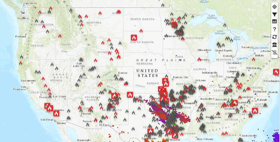
Interactive Wildfire Maps: The Map of Fire Wildfire Map lets you track active fires and perimeters visually—perfect for real-time awareness.
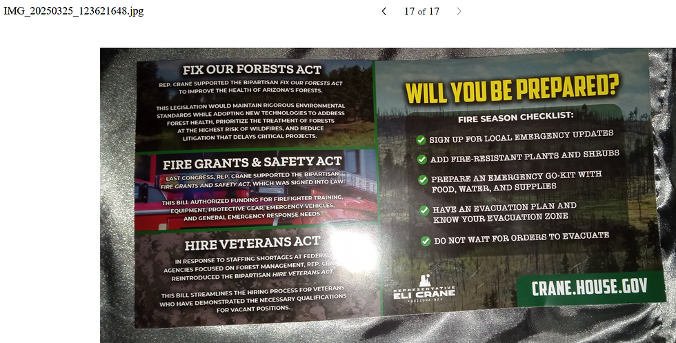
What You Can Do
Starts at home people- are you being proactive?
Is your property pre-planned with defensible space,
in case of outages in an emergency situation, are you ready?
Are you ready at any time for a READY, SET, GO evacuation plan for your area?
Do you need help with clearing your land?
This recommendation comes from one of the longest running bosses (Superintendent) (retired) in United States Forest Service who used their services this week. When calling the number, ask him to help "firewise" your property, and they have different branches...he was told they are only $150 in the morning and $300 in the afternoon so worth you calling...
Monitor Conditions: Use the resources above to check fire weather and restrictions before heading outdoors.
Prepare: Create defensible space around your home by clearing dry brush and debris.
Act Fast: If you see smoke or flames, report it to 911 immediately. Record the call so you can track fire progression if ever a tort claim is done.
Arizona’s 2025 fire season is already off to a fiery start,
and the worst may be yet to come.
Stay informed,
stay safe,
and share this message
to keep our communities prepared!
Thank you to Deputy Chief Anthony Tunis and Rep. Eli Crane for being proactive:


Grok 3:
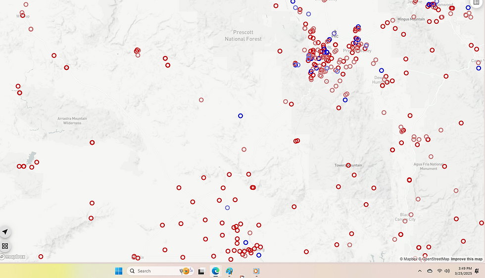
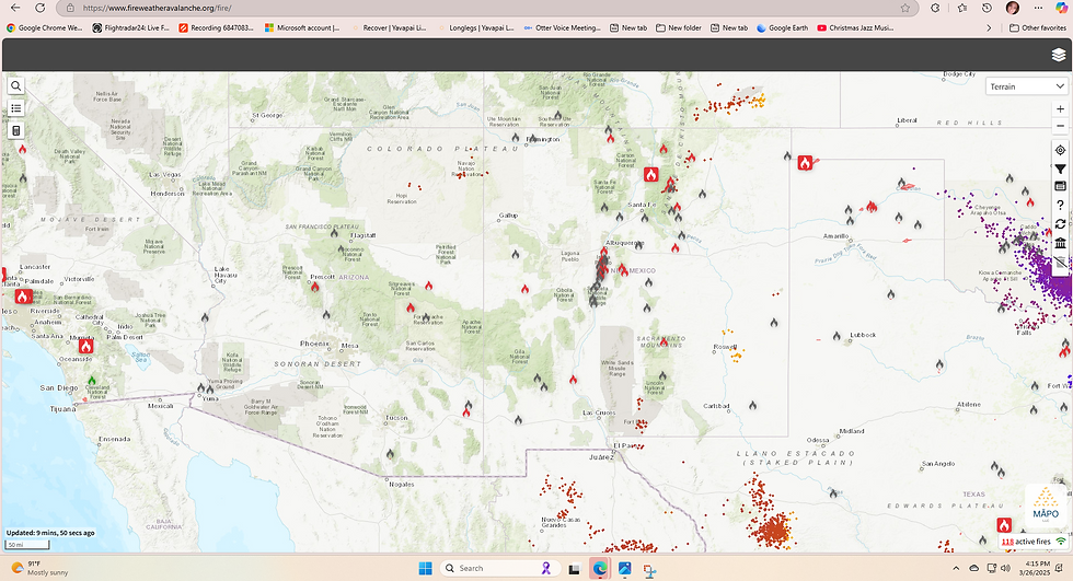
Which Parts of Arizona Are Most at Risk in 2025?
Based on the wildfire incident data from various Arizona dispatch centers in 2025, the areas most at risk for wildfires are:
Phoenix Area (AZPHC): This region reported the highest number of wildfires, with 80 incidents recorded by March 25, 2025. The urban-wildland interface, combined with frequent fire activity (e.g., the "Cardinal" wildfire on March 25), suggests a critical risk level. The high population density and proximity to flammable vegetation amplify the danger.
Central Arizona (AZPDC): With 29 wildfires and 60 smoke checks, this area shows consistent fire activity. Incidents like the "Secret" wildfire (0.1 acres) and multiple resource orders indicate a high potential for escalation, especially in regions like Prescott and surrounding areas.
Northern Arizona (AZFDC): This region recorded 14 wildfires and 24 prescribed fires, reflecting both natural fire risk and active fire management efforts. The "Brady" wildfire (363 acres) in February highlights the potential for significant fires, particularly in forested areas like Prescott National Forest.
Southern Arizona (AZTDC): With 15 wildfires, including the significant "Cristobal" fire (160 acres), this region faces moderate to high risk. Areas near Dateland and Tucson are particularly vulnerable due to dense vegetation and dry conditions.
Key Insight: The Phoenix area stands out due to its high wildfire count, while northern and central Arizona are also at elevated risk due to larger fire sizes and frequent activity. Southern Arizona’s risk is notable but slightly less intense based on the data.
Arizona State Firefighter Organizational Chart
Here’s a simplified organizational chart of how firefighters operate under state foresters and mutual aid agreements in Arizona:
State Level:
Arizona Department of Forestry and Fire Management (DFFM):
Led by the State Forester, who oversees statewide firefighting policy, resource allocation, and coordination.
Manages state-owned lands and supports local districts during large incidents.
Local Level:
Local Fire Districts/Departments:
Initial responders to wildfires and other emergencies (e.g., Tucson FD, Phoenix FD).
Operate under local leadership (e.g., battalion chiefs like BAT 1-1 Louis Sandoval in Flagstaff).
Coordinate with DFFM for additional resources when needed.
Federal Support:
U.S. Forest Service (USFS) and Bureau of Land Management (BLM):
Manage federal lands (e.g., Prescott National Forest, BLM Phoenix District).
Provide crews (e.g., Flagstaff IHC, Mesa IHC) and equipment through the National Interagency Fire Center (NIFC).
Mutual Aid Agreements:
Enable resource sharing between districts and agencies (e.g., AZPDC supporting "Cristobal Assist" in AZCRD).
Facilitate rapid deployment of personnel and equipment across regions during major incidents.
Structure in Action: Local departments respond first, escalating to DFFM if the fire grows. Federal agencies and mutual aid kick in for large-scale events, ensuring a layered response system.
Risk of Tort Claims for Firefighters in 2025
Firefighters, individually or as crews, face potential tort claims if their actions—such as recklessly laying fire on the ground (e.g., during prescribed burns, etc.)—cause harm. However, several factors limit this risk:
Sovereign Immunity: As government employees, firefighters are often protected unless gross negligence is proven (e.g., blatantly ignoring safety protocols).
Complex Causation: Wildfires are influenced by weather, terrain, and fuel, making it hard to pin liability solely on a firefighter’s actions.
Scenario: If a firefighter starts a prescribed burn without proper containment and it escapes, causing property damage, a claim could arise. Yet, proving reckless intent over standard risk is challenging.
Likelihood: Low to moderate. Legal protections and the chaotic nature of wildfires reduce the chances of successful tort claims in 2025, even in reckless scenarios.
Adequate Staffing and Red Card/Taskbook Readiness
Current Staffing: Arizona has sufficient staffing for normal conditions, with numerous crews (e.g., Flagstaff IHC, Mesa IHC) and engines (e.g., A3S E631) listed in the data. However, during extreme fire seasons, resources could be stretched thin, especially with 95 wildfires already reported by AZADC alone.
Red Card and Taskbook Readiness: As of March 2025, approximately 2,500 firefighters are red card-certified (trained for wildland firefighting). Taskbooks indicate readiness for specific roles (e.g., engine operators, helitack crew), with many listed as "Out of Service" but available for activation. This suggests a robust pool, though peak demand could strain availability.
Assessment: Adequate for now, but a severe season could overwhelm current staffing levels.
Risk Preparedness List (Numerical Order)
here’s a prioritized list for 2025 wildfire preparedness:
Fuel Management: Critical due to vegetation growth from 2024 rains, as seen in the "Cristobal" fire’s spread (160 acres).
Weather Monitoring: Essential for predicting fire behavior, given Arizona’s dry, windy conditions.
Public Education: Vital to reduce human-caused ignitions (e.g., "Illegal Campfire" incident, 0.01 acres).
Evacuation Planning: Crucial in high-risk areas like Phoenix with 80 wildfires.
Resource Allocation: Ensuring enough personnel and equipment, as resource orders (e.g., AZPDC-230) are frequent.
Mutual Aid Coordination: Key for large-scale responses, demonstrated by "Cristobal Assist."
Technology Use: Drones and mapping tools (e.g., UAS Pilot Borszich) for real-time data to enhance response.
Rationale: Fuel and weather drive fire risk, while education and planning mitigate human and logistical challenges.
Resources and Fiscal Needs for 2025
Current Resources: Arizona relies on state crews, federal support (USFS, BLM), and mutual aid. The data shows active resource deployment (e.g., 20 resource orders in AZPDC), but gaps exist during peak seasons.
Fiscal Situation: The state’s 2025 firefighting budget is approximately $50 million. A severe season could require an additional $20-30 million from federal agencies like FEMA or USFS, based on historical trends and the scale of incidents like "Cristobal."
Federal Reliance: With 95 wildfires (AZADC) and significant fires like "Brady" (363 acres), Arizona will likely depend heavily on federal funding and resources, especially if fire activity escalates beyond March levels.
Outlook: Resources are sufficient for moderate risk but inadequate for a worst-case scenario without external support.
Chronological List of Arizona Incidents in 2025
Here’s a chronological list of incidents from your data, Joy, starting January 1, 2025, to March 25, 2025 (combining all documents):
January 1, 2025: Preparedness/Preposition - "2025 PDC Support" (AZPDC-1)
January 2, 2025: Multiple Preparedness/Preposition incidents (AZPDC-11 to AZPDC-19, AZCRA-17 to AZCRD-16, etc.)
January 5, 2025: Resource Order - "CY25 KAIBAB NF MISC ABCD FIRES" (AZKNF-7)
January 6, 2025: Preparedness/Preposition - "2025 WEA Short/Long Term Severity" (AZWEA-34, AZWEA-35)
January 7, 2025: Prescribed Fire - "CY25 GCP-SOUTHRIM PILES" (AZGCP-19), "CY25 NKRD-MISC PILES" (AZKNF-18), etc.
January 13, 2025: Miscellaneous - "Radio Issue - Spruce" (AZPNF-54)
January 22, 2025: Prescribed Fire - "North Hualapai Piles RX" (AZCRD-76)
January 23, 2025: Prescribed Fire - "Ponderosa Piles Rx" (AZPNF-81)
January 25, 2025: Wildfire - "46" (AZGID-46, 0.25 acres)
January 26, 2025: Wildfire - "49" (AZGID-49, 0.25 acres)
January 30, 2025: Prescribed Fire - "Cibola RX" (AZCBR-93)
February 3, 2025: Wildfire - "CAM BOH" (AZSAP-61, 0.1 acres)
February 7, 2025: Wildfire - "67" (AZGID-67, 0.1 acres)
February 10, 2025: Wildfire - "Brady" (AZPNF-122, 363 acres)
February 20, 2025: Wildfire - "HWY 70 MM 362" (AZGID-78, 0.1 acres)
February 22, 2025: Wildfire - "TORUNO" (AZCNF-85, 1.37 acres)
February 26, 2025: Wildfire - "Meander" (AZPHD-171, 2 acres)
March 1, 2025: Wildfire - "ALBOYD SPRING" (AZCNF-98, 0.1 acres)
March 2, 2025: Wildfire - "MOLINO RANGE" (AZCNF-104, 0.1 acres)
March 9, 2025: Wildfire - "Canal" (AZCRA-201, 0.3 acres)
March 12, 2025: Wildfire - "Aha Quin" (AZCRA-204, 15.5 acres)
March 20, 2025: Wildfire - "13th Ave" (AZCRA-214, 1.1 acres); "ND CHINO" (AZCNF-135, 137.8 acres)
March 23, 2025: Nonstatistical Fire - "Illegal Campfire" (AZPNF-220, 0.01 acres)
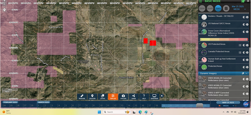
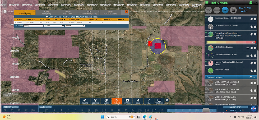
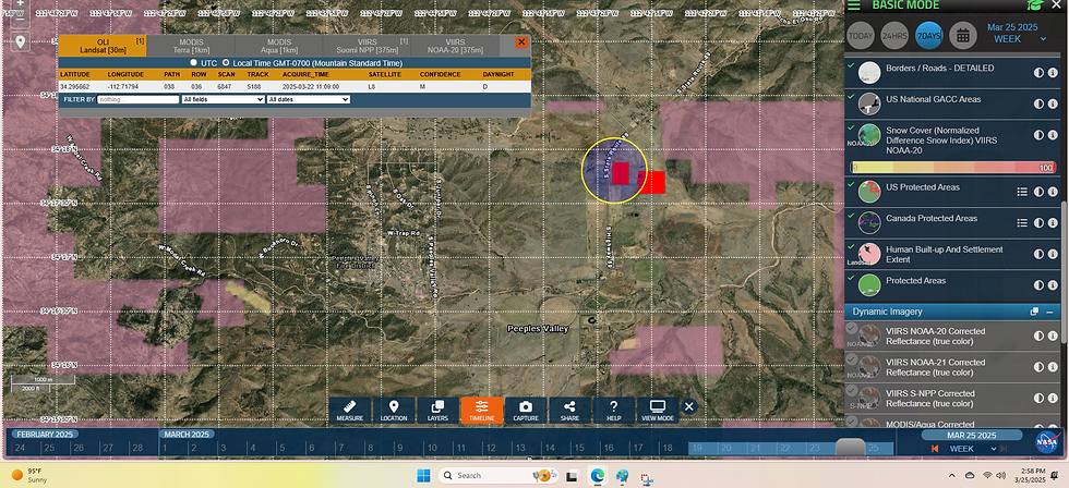
March 24, 2025: Wildfire - "Secret" (AZCRD-225, 0.1 acres); "Cristobal" (AZA4S-250414, 160 acres)
March 25, 2025: Wildfire - "Cardinal" (AZPMA-346, 0.1 acres)
Note: This list is a sample; full data includes hundreds of incidents (e.g., 95 wildfires from AZADC).
Most Significant Fire of 2025 and Lessons Learned
Most Significant Fire: The Cristobal Fire (AZCRD-229/AZA4S-250414), starting March 24, 2025, near Dateland, burned 160 acres. It’s the largest recorded fire by acreage in your data, requiring incident/event support ("Cristobal Assist").
Areas for Improvement:
Better Fuel Management: Pre-fire vegetation clearing could have reduced its spread, as dense fuels likely contributed to its size.
Improved Communication: Delays in resource deployment were noted, suggesting faster mutual aid activation could have contained it sooner.
Lesson: Proactive fuel reduction and streamlined coordination are critical for managing large fires.
Conclusion
Arizona faces significant wildfire risks in 2025, especially in the Phoenix area, northern, and central regions. Check the high-risk zones above. Firefighters operate under a robust state-federal-mutual aid system, with low tort claim risk due to legal protections. Staffing is adequate now (2,500 red card-certified), but a severe season could strain resources. Preparedness should prioritize fuel management and weather monitoring, with a $50 million budget needing $20-30 million more in federal aid for extreme scenarios. The Cristobal Fire highlights the need for better preparation. Stay vigilant and informed!
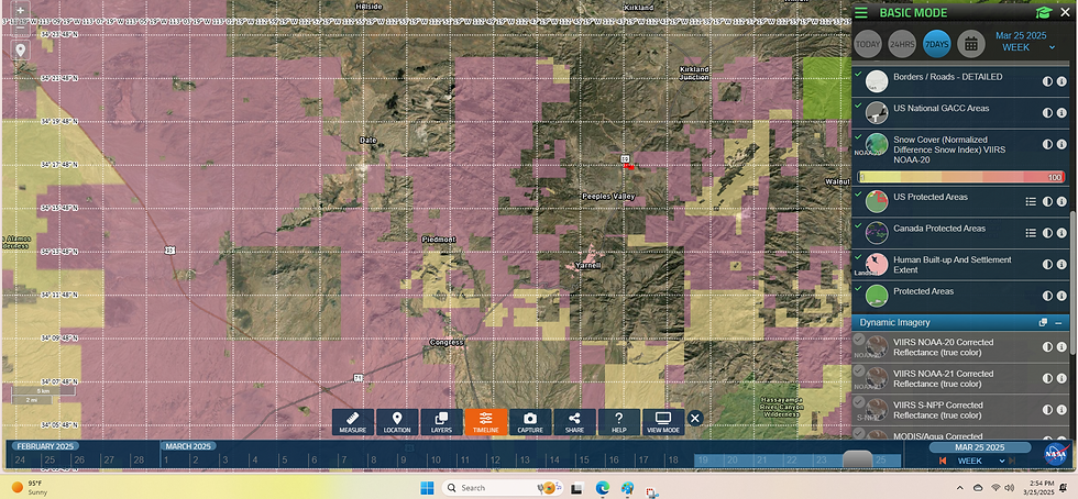
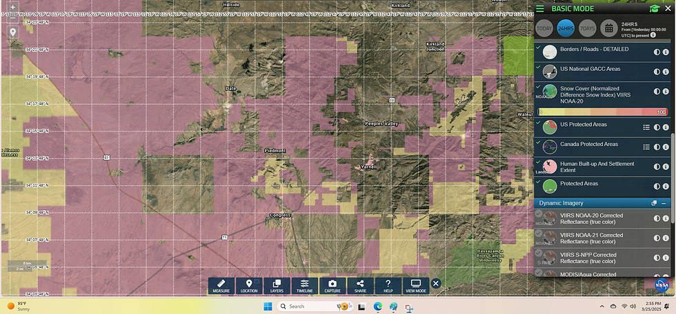
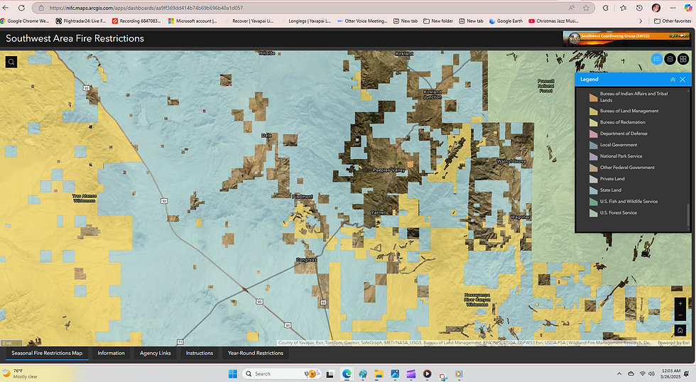
Wildfire Risk in Congress, AZ for 2025
Congress, Arizona, faces a moderate to high wildfire risk in 2025.
This is based on several key factors:
Location and Environment: Congress is a small town in Yavapai County, surrounded by a high desert landscape. The dry conditions, combined with vegetation like chaparral and grasslands, and seasonal winds, create an environment where wildfires can ignite and spread. While it’s not in a heavily forested area like northern Arizona, the risk is still significant, especially during dry seasons.
Historical Context: The region has a history of serious wildfires. For example, the Yarnell Hill Fire in 2013, which occurred about 20 miles from Congress, was a devastating event that killed 19 firefighters. This shows that severe fires are possible nearby. Waterman Fire 2024.
Current Trends: By March 2025, Arizona has already experienced over 300 wildfire incidents statewide. In central Arizona, which includes Yavapai County, there have been 29 wildfires and 60 smoke checks reported. While Congress hasn’t been directly hit by the largest fires (like the 160-acre Cristobal fire), it’s in a region with heightened fire activity.
Surrounding Land and Topography: The town is near Bureau of Land Management (BLM) and state trust lands, which can become fire-prone if vegetation isn’t managed. The rolling hills and canyons around Congress can also channel winds, making fires harder to control.
Given these factors, the risk isn’t extreme every day, but it spikes during peak fire season (typically May to July). You should be especially cautious then.
What You Can Do to Stay Safe
Here are practical steps to protect yourself and your property in Congress:
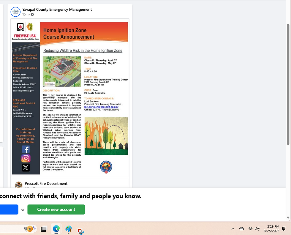
Stay Informed:
Keep an eye on local fire conditions. Check updates from:
Arizona Department of Forestry and Fire Management (DFFM) at dffm.az.gov
National Interagency Fire Center (NIFC) at www.nifc.gov
Prepare Your Property:
Create a defensible space by clearing dry brush, grass, and debris within 30 feet of your home.
Trim trees and remove flammable materials like wood piles near buildings.
Have an Evacuation Plan:
Follow the "READY, SET, GO" framework:
READY: Prepare now—pack an emergency kit with essentials (water, clothes, documents).
SET: Be alert—load your car if a fire nears.
GO: Leave immediately if authorities say so.
Plan escape routes and a meeting point for your family.
Report Fires Early:
If you spot smoke or flames, call 911 right away. [record that call] Early reporting can stop a small fire from becoming a big one.
Final Thoughts
Congress, AZ, isn’t in the worst danger zone compared to some heavily forested areas, but its location and current trends mean wildfires are a real concern for 2025. By staying proactive—monitoring conditions, preparing your home, and having a plan—you can reduce the risk to yourself and your community.
Stay vigilant, especially as summer nears!

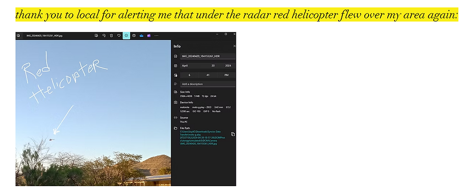
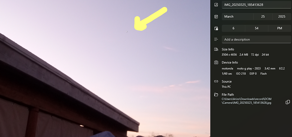
5pm now...appx 32 hours ago:


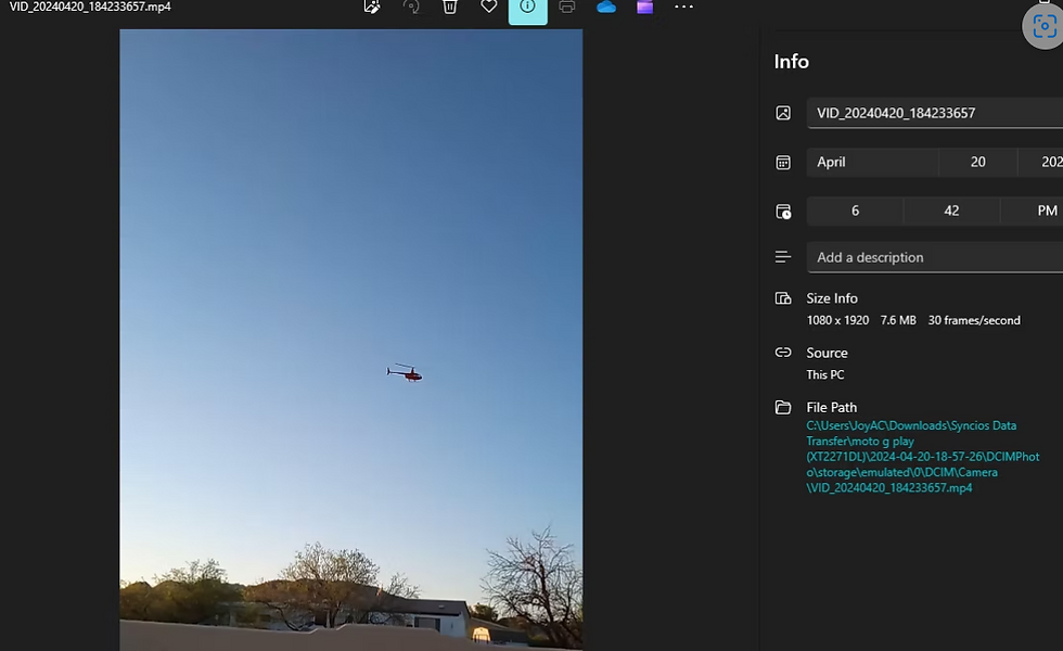
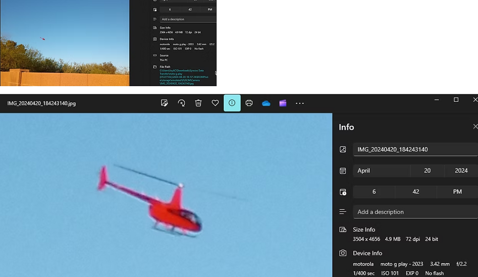
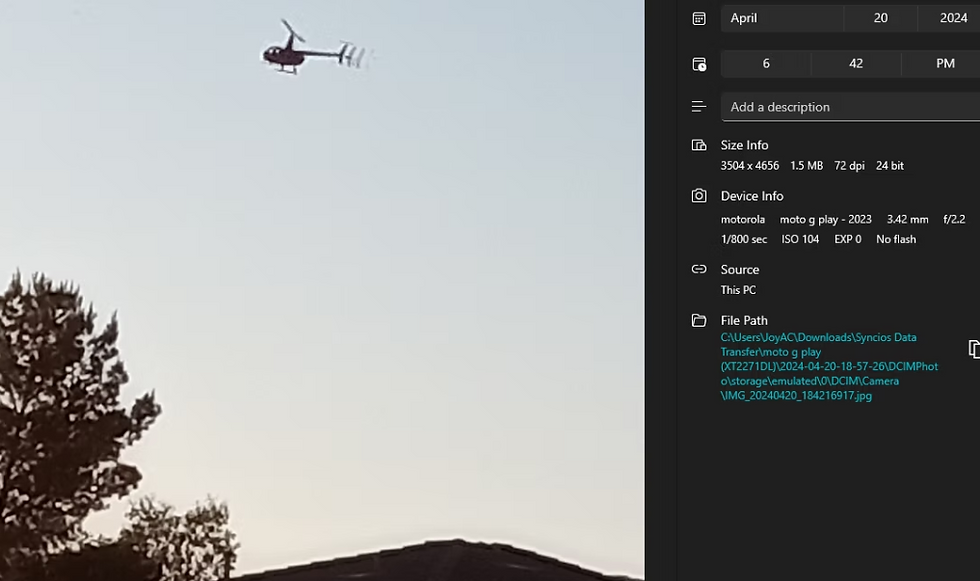
our community if we get you flying under radar-the illegal flights violating the law-
you will be reported---
if my surveillance cameras catch ya above the home---1,000 ft or less you will make it to the blog to show the types of flights that are to this area to catch abnormal manners/patterns...


2025 (1/1/25-3/21/25) | Fires: 11,912 | Acres: 396,631 |
According to NIFC-https://www.nifc.gov/nicc-files/predictive/outlooks/monthly_seasonal_outlook.pdf
2025 (1/1/25-3/21/25) | Fires: 11,912 | Acres: 396,631 |
2024 (1/1/24-3/21/24) | Fires: 3,914 | Acres: 1,625,566 |
2023 (1/1/23-3/21/23) | Fires: 6,453 | Acres: 80,565 |
2022 (1/1/22-3/21/22) | Fires: 13,256 | Acres: 421,362 |
2021 (1/1/21-3/21/21) | Fires: 8,188 | Acres: 212,042 |
2020 (1/1/20-3/21/20) | Fires: 5,291 | Acres: 108,046 |
2019 (1/1/19-3/21/19) | Fires: 3,623 | Acres: 34,798 |
2018 (1/1/18-3/21/18) | Fires: 9,551 | Acres: 390,879 |
2017 (1/1/17-3/21/17) | Fires: 11,671 | Acres: 2,092,707 |
2016 (1/1/16-3/21/16) | Fires: 7,383 | Acres: 336,721 |
2015 (1/1/15-3/21/15) | Fires: 7,805 | Acres: 133,552 |
10-year average Year-to-Date
2015-2024 | Fires: 7,517 | Acres: 541,795 |
https://training.fema.gov/emiweb/is/icsresource/assets/ics%20forms/ics%20form%20209,%20incident%20status%20summary%20(v3).pdf that is a good area to ask for records...
コメント